Day 93: a change in plans

Day 93
Miles: 3
From soldier creek to Chester

A good night’s sleep – we may be back in business. Maybe I’ll do this second half after all. That’s no reason to rush out of camp though – we continue our trend of leisurely mornings, and are still getting ready when Far-out walks up.

We’re planning on heading to the Warner campground for the night. We would have gone into Chester last night, if we could’ve gotten to hwy 36 in time to hitch, but since we didn’t we’ll skip the stop entirely.

No burgers for us, but there is trail magic. Sodas! On ice! While I’m drinking my root beer, I check for cell service, and end up on facebook. The PCT facebook groups are blowing up with posts about fires. Here. Fires here, in California section N.

“J, that fire we saw yesterday – it looks like it’s across the trail.”
  “Up ahead? Is it closed?”
  “I’m trying to figure out.” The information on the web uses real landmarks and forest service roads to describe the burn area – things that mean nothing to me. In fact, for the entire length of the trail I’ve been in the curious situation of knowing  precisely where I am, while having no real ideas of where that location itself is. I’ll know I’m at mile 1145.87 on Halfmile’s maps, two miles from water, eight miles from town (for example), but not be able to tell you what the major roads are, what towns are in the area, exactly which national forest I’m in…

It looks like this fire might definitely be in our way though. I’m puzzling over it on a slow internet connection when other hikers start arriving at the hwy 36 junction as well – Far-out, Pippin, Tarzan & Jane. Two Feathers and Pacman, who are coming out of Chester, arrive as well.

In addition to California section N, trail section P is also now closed, and it looks like section R (last section before Oregon) is going to possibly be closed soon. That’s going to make it a bit tough to hike through…

We don’t just have one reroute in front of us, we have a couple hundred miles of detours staring us in the face. Everything I find out only raises more questions. For now, however, it looks like I’m going into Chester after all. The Bald Fire up ahead is 5000 acres and growing.

Chester has a reputation as a hard hitch (only seven miles too), which it lives up to. A trail angel in town (thanks again, Tooth Fairy!) saves us the long walk and comes and picks up all of us except for Two Feathers, who decided to walk to the next town north, Old Station.

I feel so derailed by this. Getting up and keeping walking is hard enough without decisions. I think back to J on Muir Pass, saying how the PCT is something he decided to do once, and he simply hasn’t reevaluated. I’m afraid that if I have to reevaluate, I’ll just go home. Back to where I’m not tired all the time, to where my feet don’t hurt all the time. The PCT isn’t a trip, it’s a pilgrimage. If I’m going to skip hundreds of miles, what’s the point?

There’s an art fair going on in town,  and there is no room at the inn. Any inn. They’re all full. The local Lutheran pastor takes us in, and lets us camp in the backyard of the church (appropriate). The local dentist gives us gift certificates to eat at the restaurant across the street, where we munch fish tacos and digest the turn of events. J wants to hang out – I want to know what we’re doing with our lives.

I’ve gone back to the church to mull things over, when J comes back with 3D in tow. “Bicycles!” she announces. “Pacman and I are going to ride bikes to Ashland.” They’ve hooked up with a local guy who fixes up old bikes, and they’re going to try to bike around the detours. They’ll check out the bicycles tomorrow.

Bicycles! The idea is crazy – I’ve never ridden a bicycle more than 20 miles in a row in my life – but it’s the first idea that has made me want to continue this journey. We’d ride out to the coast, ride on California 101, see the redwoods… it’s exciting, unscripted, but has that thread, that continuity I need to carry me through. I guess I’ll find out tomorrow if this is even feasible.

Meanwhile, the Bald Fire is growing. 18,000 acres now.

We heat up cans of soup on the church’s back porch, tell stories and laugh, get ready for bed. 26,000 acres. “What do you think about this?” I whisper to J, lying next to me in his sleeping bag.
  “If the bikes look good, let’s do it.”
  “Sounds good.”

Let’s see what tomorrow brings.

Share

Day 89: downhill blues

Day 89
Miles: 28
From lookout rock to Belden

A cloudy, cool morning – without the sun beating on our faces, we once again don’t get up early. I think getting up is the hardest thing I’ve ever had to do… and I have to do it every single day. We want to make it to Belden tonight, and we want to make it in time for burgers – and that means 28 miles.

The best part of doing big miles once, is that afterwards, everything seems a little easier. Now that we’ve done a 29, I guess 28 won’t be so bad.

We take it easy and do nine miles to Buck’s Lake Road and snacky-cakes time. Packs down, feet up, we’re minding our business when a big, white truck drives past, flips a U-ie, then pulls up next to us. “You guys PCT hikers?”
  “Yeah.” You never know what’s going to come after that question –
  “You want a watermelon?”
  “Well, ok.”
The guy pulls out a watermelon, must’ve been ten pounds! What the heck are we going to do with a ten pound watermelon?
  “Where are you two planning on heading tonight?” inquires the guy.
  “We’re headed for Belden.”
  “Belden? Ha!” he scoffs. “What is that, seventeen miles? You’ll never make it.”
  “It’s actually nineteen from here,” I correct. The guy pays no attention.
  “That’ll take ten hours! Nah, you won’t make it. You’ll stop at Three Lakes and get to Belden tomorrow.” And with those words of encouragement, he gets in his truck and drives away.
  “Well, nothing like being told you can’t do something,” observes J.
  “No kidding. What weird trail magic.”

We slice up the watermelon, stuff ourselves, slice up some more and pack it for later, and we still have half the blasted thing. “What do we do with this now?” I ask J.
  “Beats me.”

The watermelon ends up left on top of a sign with a big metal post, with a note telling what time we cut it. Bad form, leaving food out like this, but we’re not sure how else to deal with it. It’s too much to eat and too much to carry. I hope all the trash I’ve picked up on the trail so far will atone for my leave no trace sins.

Noon, and nineteen miles left. We start up the hill. Up Buck’s Peak, the view opens up to the north, a sweeping vista of green mountains after green mountains after green mountains. A big peak, far on the horizon, might be Lassen? Cumulus clouds look like they’re trying to build into thunderheads, but don’t quite make it.

image

image

Silver Lake

The climb is over, but we rollercoaster along for a while, finally running into a southbound pair of hikers. They give us the beta on Belden – the trail angels in town, the Braatens, are going to close up in a few days, but they’re still open. If we want to get picked up, we have to call before six. Six… It’s three o’clock, and we’ve got eleven miles left. We’ve never made that kind of time. Ever. Not even close. Maybe today’s the day? We take off faster than we’ve ever gone before.

image

Our feet are killing us, our muscles are cramping, and we go! The last seven miles are all downhill, and we stand on top of the crest, looking down a dizzy slope that spins our heads. I’m not so sure this a good idea anymore. “J, I don’t know if I’m still up for this.”
  “Me either.” But going downhill fast doesn’t hurt any worse than going downhill slow, so we keep hitting it.

image

We’re making time, but this might be the worst I’ve ever felt. I think I might have torn something, but what am I going to do? The only way out is through.

I get reception while still up on the ridge, so I call the Braatens. “I stop pickups at 7:30, will you be down by then?”
  “Yes!”
  “Call me back when you get in!”

We’ll get in before 7:30 for sure, but what about burgers first? Down the switchbacks, on the double.

Limping hard, we drag into Belden. It’s 6:09. We made it. Burgers and steak sandwiches and root beer. The locals laugh at my hobble. Brenda Braaten comes and takes us home. Hot shower. Phone service. A bed. I hope I can walk tomorrow.

Share

Day 67: someplace old/ someplace new

Day 67
Miles 10
From Tuolomne Meadows to meadow with rock

  “Wow, that’s quite a total!” Exclaims the man behind the cash register. J and I have opted to resupply at the Tuolomne Meadows store instead of mailing ourselves a box. It ain’t Wal-Mart prices, but it’s ok. We’re buying 150 miles of food – seven days if  we’re fast, eight days more realistically. Estimating a dollar a mile works pretty well to keep our bellies full, but we’ve only rung up $250 of groceries at the little store. The cashier might be impressed, but that leaves us fifty bucks short… We look at each other.
  “It’s a lot, but I don’t know if it’s enough,”  J replies.
  “Let’s just go repack it and see how it looks,” I tell him.

Overwhelmed by the piles of food that we divvy up, we do not buy any more food. We have to carry this mountain of pop tarts, mac n’cheese, crackers, candy bars. Surely it’s enough?

It’s a gray, drizzly day. Matches my attitude. We sit at a picnic table with some other PCT hikers, not hiking.

We’re approached by a man in a sweater, with a beautiful handlebar mustache. He’s an artist, taking portraits of people of Yosemite. Today, that’s us. He lets us pose however we want, and I lean on my trekking poles, look straight at the photographer as he ducks under his little black curtain to click the shutter on his old fashioned 4×5. Every cell in my body feels self aware and tingly with the force of the full attention of another human being. When was the last time I was looked at so completely? To be seen as I am, or as I wish I would be?

Since we’re already holding our trekking poles, packs on, shoes tied, standing on the trail even, it must be time to go. Is thru-hiking turning into a chore? An exercise in self punishment?

We walk through the gray day into the meadow, smooth gray domes populating the horizon, smooth, gray water running through the field. We come to the waterfalls before Glen Aulin, think of the Davids. J falls asleep on a rock, I lean on my pack.

The Grand Canyon of Yosemite is opening before us but we take a hard right turn to the north. “I hiked here with my dad once,” J mentions. “We camped at a meadow with this incredible giant rock. We sat up there on it, watched a big, beautiful owl fly below us.” The giant rock appears before us, size of a house. It’s drizzling again. We planned on going another five miles, but we set up the tarp behind the house-boulder. Home again.

image

image

image

image

image

Share

Day 62: rough start

Day 62
Miles: 18
Over Selden Pass to the perfect campsite

Can’t break the streak of late-starts. We had camped close by our friends Purple and Carnivore, early risers, and we hoped that they’d have a good influence on us… but we wake up to full sun and no sign of them. They must have snuck out of camp hours ago.

With all that sleeping in, surely hiking should be going better? We’ve only made two miles and I’m crashing hard. Today is not my day – either that or the Sierras are gradually, inexorably taking me down.

I collapse by a small, pretty lake. “Oh man,” says J. “Look at that lake. Look at those trout!”
  “Catch me some?”

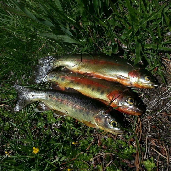
Pop, pop, pop! Three trout, all in a row. J spends another half hour catching the last one, I clean them and put them in with foraged green onions. Food of the gods! “You’re never going to enjoy another trout dinner again,” declares J. What could compare with this? Maybe I can hike today after all.

image

image

Selden Pass goes easy. There’s a nice shear zone through the granite, the rock breaking off in thin plates. A cheeky ground squirrel sits by us on top of the pass, sharing the view (but not our snacks, too bad for him.)

image

Down, then up. The reliable down the pass, up the pass pattern is over. It’s a steep ridge, but the uphills always come through for us. Instead of pines, pines, pines, we’re in aspens. The undergrowth is flush with lupins and lilies.

image

image

(I know, this is a columbine, not a lily.)

Going up inexorably leads to going down. A little vitamin I eases the descent. We cross the bridge over Mono Creek and it’s getting late. I don’t think twenty miles are in our future, but perhaps?

image

image

More uphill, but the walking is hard. Rocky hard. Hunger cramps. No more gas.

Then we see it – the perfect campsite. It’s across the creek, flowing downhill on a smooth granite chute, in a little grove of trees. “There it is,” I point out. Home. I roll a boulder into a narrow spot in the creek and we hop across. The tarp is an easy one tree pitch, then pasta sides and bed.

Share
post

Day 44: dry endings

Day 44
Miles: 12
From walker pass to Joshua tree spring
June 14, 2014

I was ostensibly planning on getting up early today, but even last night I knew that wasn’t going to happen. “We have to check out by eleven,” I think. “No rush.”

And we don’t. We make it to the bus stop by 9:45, but we read the bus schedule wrong – the bus goes to Onyx at eleven, not ten… Time for smoothies then.
Read More

Share
post

Day 6: twenty miles

Day 6
Miles: 20
Mile 71 (anza borrego) to mile 91 (san felipe hills)

J is telling me to wake up – it’s morning. I’m totally stiff – I don’t think I moved once the entire night. Our little campsite is calm and quiet. We’ve got some miles to make.

The trail has taken us through the hills of Anza Borrego state park, then traversed across their north face. Today we’ll need to finish the traverse, cross the valley, then head back up the San Felipe hills. We can see the switchbacks from here. There are no water sources in reach today. There are two water caches, but last I heard the scissors crossing water cache was no longer being maintained, and I don’t know much about the other. J and I still have nearly nine liters apiece, so we’ll be fine regardless, but we’re starting out heavy. I feel very grounded, as in, pressed into the ground.
Read More

Share